

Introduction
Nitrate pollution in aquatic environments has become a serious global issue due to increasing human-induced nitrogen inputs from agriculture and urbanization. Tropical forest ecosystems are considered to have a higher risk of nitrogen saturation even under natural conditions compared with temperate regions. In Southeast Asia, where many developing countries are located, urbanization, industrialization, and agricultural expansion are occurring simultaneously with population growth and economic development, resulting in increasing nitrogen inputs. In Malaysia, oil palm plantations are widely developed as an important agricultural industry, and chemical fertilizers are commonly used to maintain high productivity. Therefore, understanding how nitrogen moves through aquatic environments has become increasingly important in catchments where tropical forests, urban areas, and agricultural lands coexist.
Nitrogen sources and water flow can be traced using isotopes. Nitrate sources such as sewage, livestock waste, chemical fertilizers, and soil-derived nitrogen have different nitrogen and oxygen stable isotope values (The δ15N-NO3- and δ18O-NO3- values) that can be used like fingerprints to estimate nitrate sources. In addition, nitrate dissolves and moves easily with water, so understanding water flow using water isotopes (The δ18O-H2O and δ2H-H2O values) is important for clarifying nitrogen transport and runoff processes. Therefore, this study aims to clarify nitrogen sources and nitrogen transport processes using isotope tracer method in a tropical mixed land-use catchment, including tropical rainforest, oil palm plantations, and urban areas.
Methodology.
The study area is the Langat River Basin (2,350 km²) in Malaysia (Figure 1). The major land uses in this catchment consist of tropical rainforest in the upstream area, urban areas in the middle reaches, and oil palm plantations in the downstream area. River water and irrigation drainage water were collected during the wet season, dry season, and inter-monsoon season. Water isotopes (Figure 2), nitrogen and oxygen stable isotopes of nitrate, and major dissolved ion concentrations were measured.
Findings from this study
• Nitrate concentrations in river water increased from the upstream to midstream and slightly decreased toward the downstream area. In contrast, nitrate concentrations in irrigation drainage water were relatively low, and denitrification was observed. However, all nitrate concentrations in river water and irrigation drainage water were below the water quality standard for Malaysia.
• Relationships between land use and nitrate concentrations showed that nitrate concentrations decreased with increasing forest cover in the catchment. Although tropical forests are considered to have a potential risk of nitrogen saturation (Matson et al., 1999), these results suggest that nitrogen loading from forested areas in this catchment is relatively low.
• In the midstream area, nitrate concentrations increased with increasing urban land cover, suggesting influence from urban-derived nitrogen sources such as sewage and livestock waste.
• In the downstream area, the δ15N-NO3- values approach that characteristic of ammonium fertilizer–derived nitrate as the proportion of oil palm plantation areas within the watershed increases. This indicated that nitrate originating from ammonium fertilizers represents the dominant source of nitrate in the downstream river, where oil palm plantations dominate the landscape.
• Water isotope results showed that river water in the downstream plantation area had different isotope signatures from other river water samples and rainfall, suggesting mixing with water from different sources such as groundwater or subsurface water.
• Integrating these findings, the nitrogen loading structure in the Langat River Basin suggests that natural nitrogen input from tropical forests in the upstream area is relatively small, urban-derived nitrogen is the dominant source in the middle reaches, and plantation-derived nitrogen influences downstream river water through subsurface pathways.
Conclusion
In the tropical mixed land-use catchment, nitrate sources were strongly controlled by land use. Previous studies based mainly on nitrate concentration monitoring suggested that the influence of nitrogen loading from oil palm plantations was relatively small. However, by using isotope techniques, this study revealed for the first time that fertilizer-derived nitrogen from plantations was flowing into river water. On the other hand, nitrate concentrations remained relatively low, suggesting that natural nitrogen attenuation processes such as denitrification were occurring within the catchment.
References
Matson, P. A., McDowell, W. H., Townsend, A. R., & Vitousek, P. M. (1999). The globalization of N deposition: ecosystem consequences in tropical environments. Biogeochemistry, 46, 67–83. https://doi.org/10.1007/BF01007574
Xuan, Y., Liu, G., Zhang, Y., & Cao, Y. (2022). Factor affecting nitrate in a mixed land-use watershed of southern China based on dual nitrate isotopes, sources or transformations? Journal of Hydrology, 604, 127220. https://doi.org/10.1016/j.jhydrol.2021.127220
Pardon, L., Bessou, C., Nelson, P. N., Dubos, B., Ollivier, J., Marichal, R., Caliman, J., & Gabrielle, B. (2016). Key unknowns in nitrogen budget for oil palm plantations. A review. Agronomy for Sustainable Development, 36, 1-21. https://doi.org/10.1007/s13593-016-0353-2
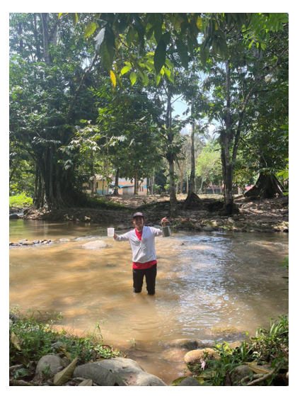
Figure 1: Upstream of Langat River Basin
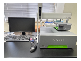
Figure 2: Wavelength-scanning cavity ring-down spectroscopy for water isotope analysis at Shinshu University, Japan
